Features Skogsvinge
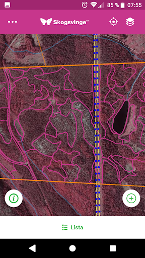
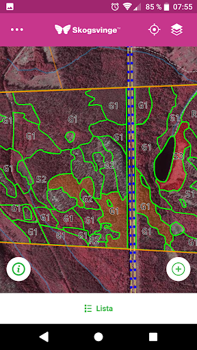
The Forestry Wing, you can see your forest property from different perspectives, from a consolidated view of the forest in the map for detailed information on the height of the trees and the forest volume (growing stock) and density.
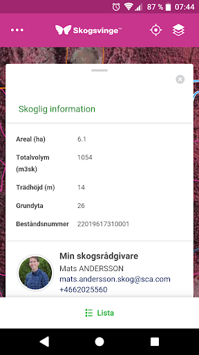
If you have a forest management plan, you also have access to plan information such as: department descriptions and species distribution. Forest Vinge app is well supported when you are out in your forest.
Perhaps you want to highlight a windfall or draw in an area you want to discuss with your advisor forest.
Navigate your position using GPS, take a picture, upload it and make a note and then tie the information to a selected point or area on the map.You do not need Internet access to work in the forest Vinge app.
The only thing you need to do is download your property in the off-line mode.Working with its forest of Forest Vinge app is as secure and simple as managing their banking online and you simply log with your bank ID.Examples of functions• consolidated view of your forest property in map• Draw an area or highlight an item in the map• Upload a photo or make a note and tie it to the selected area or point on the map• View the soil structure• View tree height, forest volume (vireksförråd)• View and work with your forest management plan• GPS navigation• Simple contact with SCA forest advisor• Safe and easy login with bank IDHow to get started1.
Download Forest Vinge app2.
Log in with your mobile banking ID3.
Download your property4.
Clear
Camera Features
Advanced camera features with editing capabilities.
Fitness Tracking
Track your workouts and monitor your health metrics.
Financial Tools
Manage your finances and track your expenses easily.
See the Skogsvinge in Action
Get the App Today
Available for Android 8.0 and above